The Penistone Line Trail

The trail runs from Sheffield to Huddersfield, between all 17 of the Stations on the Penistone Line, highlighted in 16 route leaflets available to download below. Covering immensely varied landscapes from inner urban to woods and farmland. It crosses and mingles with many ancient footpaths, causeys, packhorse trails, canal towpaths, and disused railways. The walk passes through three local authority areas in Sheffield, Barnsley and Kirklees.

Penistone Line Partnership

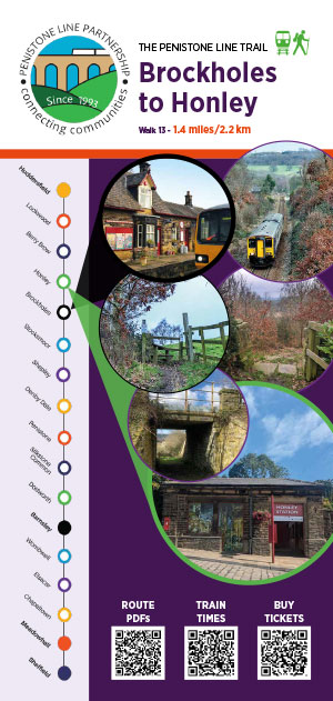
Between Sheffield and Barnsley, the trail follows the rivers Don and Dearne. The land undulates between Barnsley and Huddersfield again following the Dearne, and then the trail drops down into the Upper Don Valley at Oxspring. It then rises and descends into valleys and streams which eventually become the young Dearne. The route then crosses into the Holme Valley, which joins with the Colne Valley at Huddersfield.

The remains of mining activity are in evidence along the whole of the route. The ancient history of the region is seen in the ramparts of the Iron Age fort at Wincobank, above the Don Valley at the eastern end of the walk and the earthworks of Castle Hill at Almondbury looming over Huddersfield in the west.

Agriculture is a major activity around the trails with dairy farming and some arable in the east changing emphasis to cattle and sheep in the west.

Sheffield and Rotherham are known for the production of high-quality steels and cutlery. Barnsley’s industries include glass, textiles and metal products. Huddersfield is known worldwide for fine worsteds, textiles and engineering products.

Your guide to enjoying parks, waterways and the countryside. Countryside Code Summary

1. Sheffield to Meadowhall

4.7 miles. Follows the tranquil Sheffield and Tinsley Canal to Meadowhall. 

2. Meadowhall – Chapeltown

4.5 miles. Follows the valley of Blackburn Brook, a tributary of the River Don.

3. Chapeltown to Elsecar

6 miles. History, industrial heritage and woodland denote this section of the Penistone Line Trail. 


4. Elsecar to Wombwell

2.9 miles. Follows the Dearne & Dove Canal from the historic industrial town of Elsecar.

5. Wombwell to Barnsley

5.8 miles. Monk Bretton Priory is worth a visit and Dearne Valley Park is a green corridor into the heart of Barnsley.

6. Barnsley to Dodworth

5.8 miles. From the market town of Barnsley, a walk near the River Dearne leads to areas of rich industrial heritage.

7. Dodworth to Silkstone Common

3.3 miles. This section passes through the centre of Dodworth, (Dodworth Cross) through Silkstone Fall Wood and onto back lanes into Silkstone Common.

8. Silkstone Common to Penistone

3.8 miles. The railway climbs up to and through Oxspring tunnel into the Don Valley. Our route generally follows the Trans Pennine Trail (TPT), 

9. Penistone to Denby Dale

6.2 miles. Through the hidden and beautiful Gunthwaite valley, onto Denby Dale – the Pie Village.


10. Denby Dale to Shepley

2.6 miles. Extensive views include Thurstonland Church, Castle Hill and Emley Moor Television masts.

11. Shepley to Stocksmoor

1.5 miles. A short walk, taking you across the boundary into Shelley, past the location of two old corn mills, along Shepley Dike (also called Thunder Bridge Dike) to Thunder Bridge and up the hill to Stocksmoor village. 


12. Stocksmoor to Brockholes

2.5 miles. The railway uses the 1631 yard Thurstonland Tunnel to facilitate a descent into the Holme Valley. We climb gradually, crossing fields and pathways to Thurstonland Village then descend deeply to Brockholes Station. 

13. Brockholes to Honley

1.4 miles. The railway maintains an elevated position in the valley by means of a huge embankment on the approach to Honley. This section offers stunning views across the Holme Valley.

14. Honley to Berry Brow

1.5 miles The line continues on the hillside above the River Holme as the short Honley tunnel and the longer Robin Hood tunnels facilitate its progress to Berry Brow. We climb towards Castle Hill to enjoy fine views over Honley, Netherton and further afield.

15. Berry Brow to Lockwood

1.7 miles. The train emerges from a deep rock cutting offering passengers an elevated view of distant Huddersfield from the majestic Lockwood Viaduct as the line sweeps across the Holme Valley to Lockwood. 

16. Lockwood to Huddersfield

1.7 miles. An urban stroll, leading to well-trodden paths above the industrial landscape, alongside the railway, and into the town centre referred to as Oderesfelt in the Domesday Book.

Our funders who made the design and publication of the Penistone Line Trail guides possible are CrossCountry, through their Community Engagement Fund, and Community Rail Network through their Community Rail Development Fund. 

Funders of the Penistone Line Trail leaflets, Cross Country and Community Rail Network

 The train operator for the Penistone Line is Northern. 

Penistone Line Partnership has endeavoured to ensure the accuracy of the information contained within the trail guides and reserves the right to revise and update the contents without obligation to notify any person of such changes. Despite every effort to the contrary, errors, omissions or discrepancies may have occurred in preparation of the guides, and Penistone Line Partnership assumes no liability for loss or damages incurred due in part or in whole to such errors. 

All contents of the Penistone Line Trail Guides in printed and digital formats are © Penistone Line Partnership 2023.